TRAILHEAD · COLUMBIA RIVER GORGE · OREGON / WASHINGTON

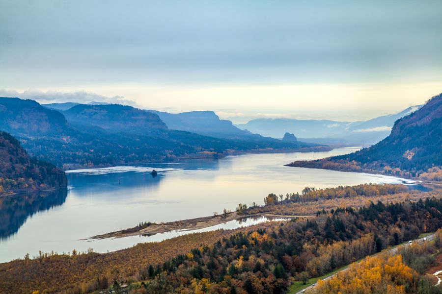
The Columbia River cut through the Cascade Range over millions of years and left behind a canyon with walls of exposed basalt, dozens of waterfalls that drop from the rim to the river, and a micro-climate that supports over 800 plant species, more than anywhere else in the Pacific Northwest. In April and May, the gorge is essentially one continuous wildflower display. You run through color.
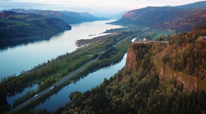
The Historic Columbia River Highway State Trail is the spine of the gorge trail system on the Oregon side: a paved corridor connecting the major waterfalls, but with singletrack connectors that climb above the highway into old-growth fir and descend to basalt overlooks where the river is 800 feet below. The wind in the gorge is constant and directional: west to east, always, funneled by the terrain.
The Latourell Falls to Wahkeena Falls loop is the classic gorge route: about six miles connecting two waterfalls via ridge trail above the highway. Latourell drops 249 feet in a single plunge off a basalt column; Wahkeena cascades in three distinct tiers through a side canyon. Between them is a mile of exposed ridge with river views that justify every foot of climbing to get there.
For more distance and elevation, the Angel's Rest to Devil's Rest traverse adds 1,200 feet of climbing and a summit viewpoint above the treeline. On clear days the view encompasses 40 miles of river corridor in both directions. On cloudy days, which is most days, you are running through cloud, which is its own experience.


The Eagle Creek fire of 2017 burned 50,000 acres of the gorge and closed major sections of trail through 2020. The recovery has been dramatic: the understory has regenerated with a density that ecologists describe as exceptional, and the fire-scarred snags that remain have become habitat for cavity-nesting birds in numbers not seen in decades. The gorge is, in the most literal sense, growing back. You can see it in the new-growth fir coming up through the ash soil.


OFFICIAL TRAIL MAP · COLUMBIA RIVER GORGE NATIONAL SCENIC AREA · USDA FOREST SERVICE
The Columbia River Gorge National Scenic Area is managed by the USDA Forest Service. Download or view the official trail maps and recreation guide directly from the Forest Service.
Download Official USFS Trail Map (PDF)Columbia River Gorge National Scenic Area -- USDA Forest Service
The gorge is wet from October through June; trail shoes with grip over cushion. Wind can be severe at exposed viewpoints; a shell layer is not optional. Parking at major trailheads requires a NW Forest Pass. Weekends are crowded; run weekday mornings or arrive before 8am on weekends.
The thing about the gorge that photographs cannot capture is the sound. Water everywhere: the river below, the waterfalls audible from the ridge, the side creeks crossing the trail every quarter mile. The Pacific Northwest is generous with its water. The Columbia River Gorge is where you understand why that matters.