TRAILHEAD · HURRICANE RIDGE · OLYMPIC NATIONAL PARK, WA

There are places in the Pacific Northwest that the weather treats as personal. Hurricane Ridge is one of them. The road climbs 5,200 feet from Port Angeles in seventeen miles, passing through three weather systems on any given morning: coastal overcast, a band of cloud forest rain, then, if you time it right, sudden emergence into sunlight above everything. The name is not rhetorical. Winds here have exceeded 100 miles per hour.
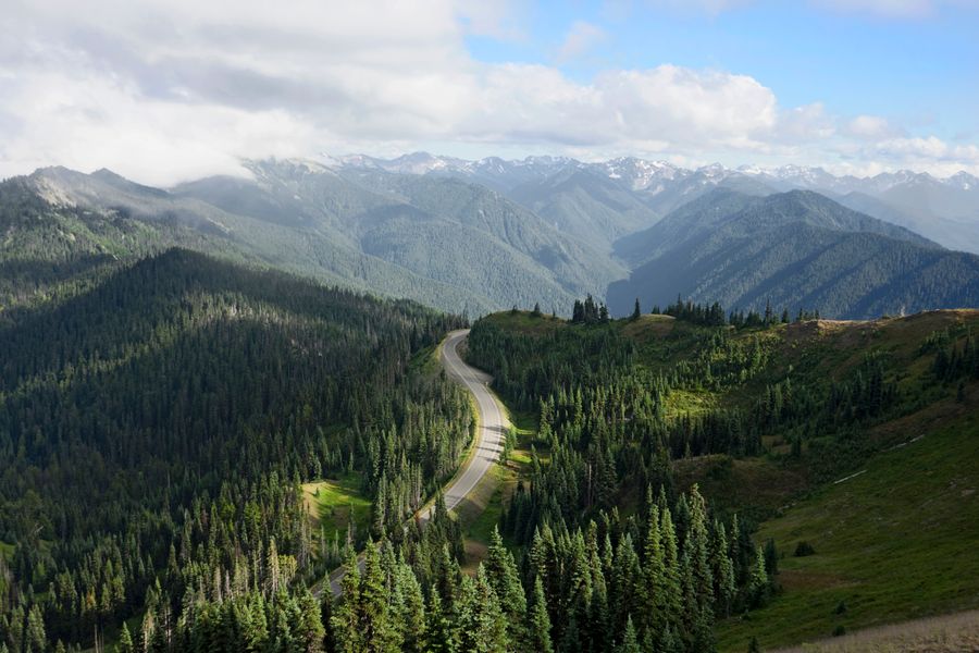
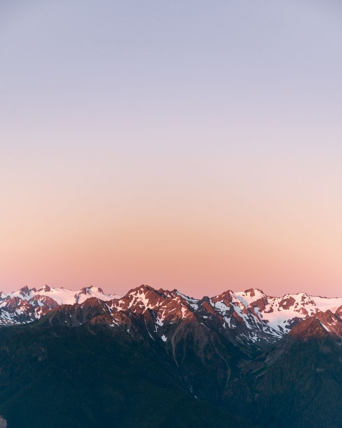
But on the right morning, in the right window, Hurricane Ridge is as close to a rooftop run as the Pacific Northwest offers. The ridgeline sits above the cloudbase. The Strait of Juan de Fuca is below you. Vancouver Island is visible to the north. The Olympic Mountains, glacier-carved and still holding snow in June, rise in every other direction.
The Hurricane Hill trail is the standard line: 3.2 miles round trip from the visitor center, entirely above treeline, entirely exposed. It gains 700 feet over 1.6 miles of ridgeback trail with drop-offs on both sides. The payoff is a 360-degree summit view that, on a clear day, includes Mount Baker to the northeast and the Cascades beyond.
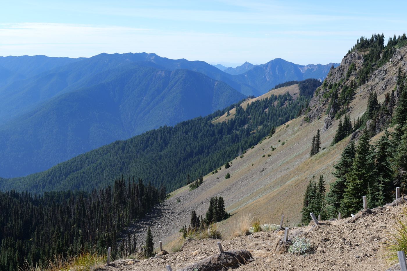
For runners wanting more vertical, the Switchback Trail descends from the ridge into subalpine forest, connecting to a network that adds elevation and technicality. Budget four to five hours if you go deep into the backcountry. This is terrain where reading technical trail becomes essential. The exposed ridgeback requires eyes ahead and confident footing at all times.

Black-tailed deer move through the meadows below the ridge without concern. Roosevelt elk, the largest elk subspecies in North America, are occasionally spotted on the slopes above the visitor center. Olympic marmots, found nowhere else on earth, whistle from the rockfields. This is not a run where you keep your eyes on the trail.
The road to Hurricane Ridge closes in winter and often into spring. Check Olympic NP road conditions before driving. Afternoon thunderstorms build over the Olympics in summer; be off the exposed ridgeline by noon if clouds are developing.


OFFICIAL TRAIL MAP · OLYMPIC NATIONAL PARK · NATIONAL PARK SERVICE
Source: National Park Service -- Olympic National Park · Hurricane Ridge Area Map
Temperature drops fast above 5,000 feet; a wind layer is mandatory even in August. Lightning is a real hazard on the exposed ridge. No water on trail; fill at the visitor center. Check NPS Hurricane Ridge conditions the morning of your run. Traction devices required in early season if snow remains.
The drive down from Hurricane Ridge is its own decompression: seventeen miles of forest reappearing, the clouds thickening below, Port Angeles materializing at sea level. It wasn't a dream. You just ran above the weather.