The Lost Coast: California's Most Remote Run

The Lost Coast: California's Most Remote Run

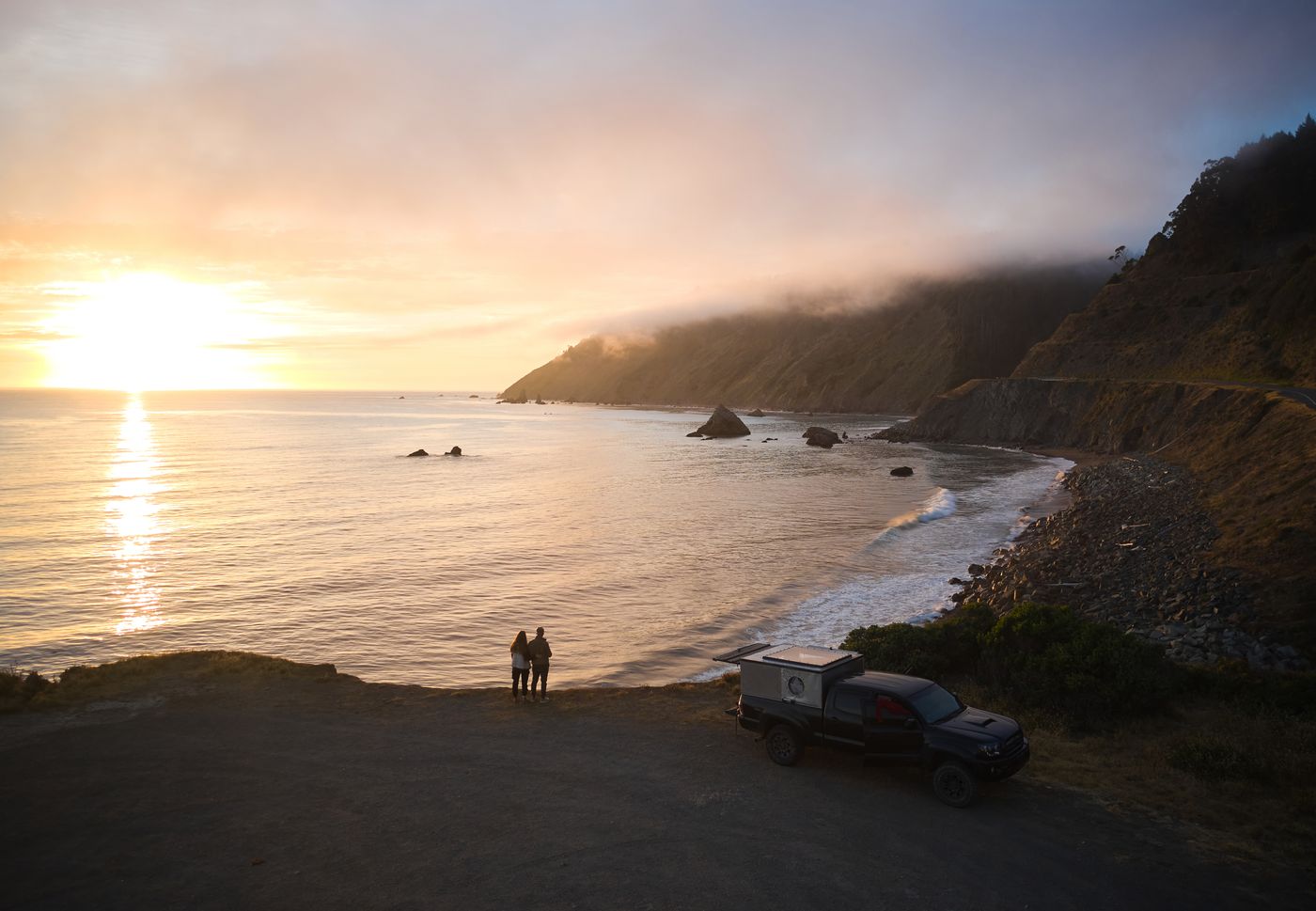
TRAILHEAD · KING RANGE NATIONAL CONSERVATION AREA · HUMBOLDT COUNTY, CA

Dramatic waves crashing against rugged California cliffs on the Lost Coast, Humboldt County

When Caltrans engineers surveyed the Northern California coast in the 1930s, they concluded that twenty-five miles of it were simply unbuildable. The King Range mountains drop directly into the Pacific here: no shelf, no terrace, no room for a road. So they routed Highway 1 inland through the Eel River valley and left the coast to itself. That is why it is called the Lost Coast. Not lost in the sense of forgotten. Lost in the sense of having escaped.

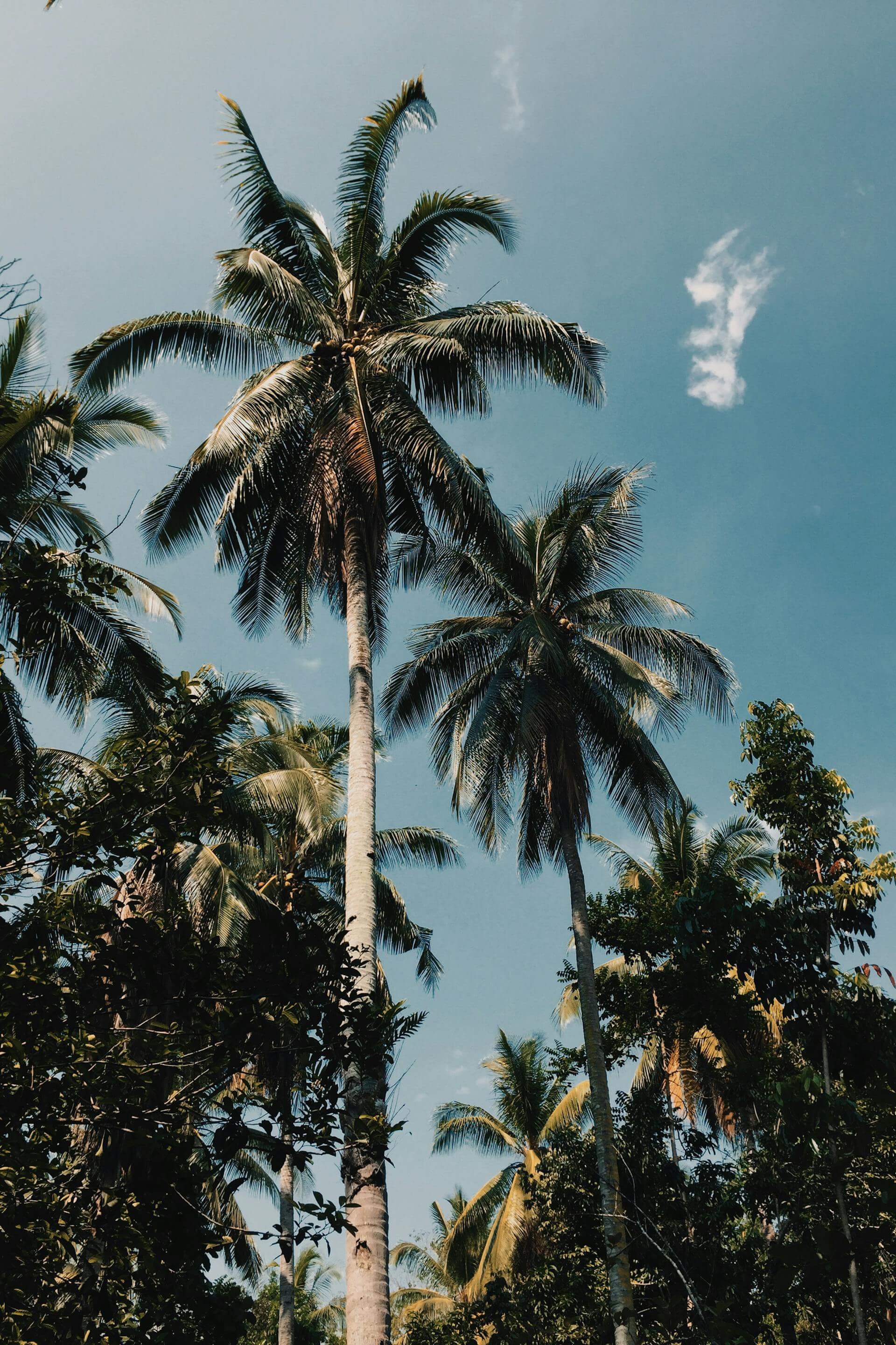
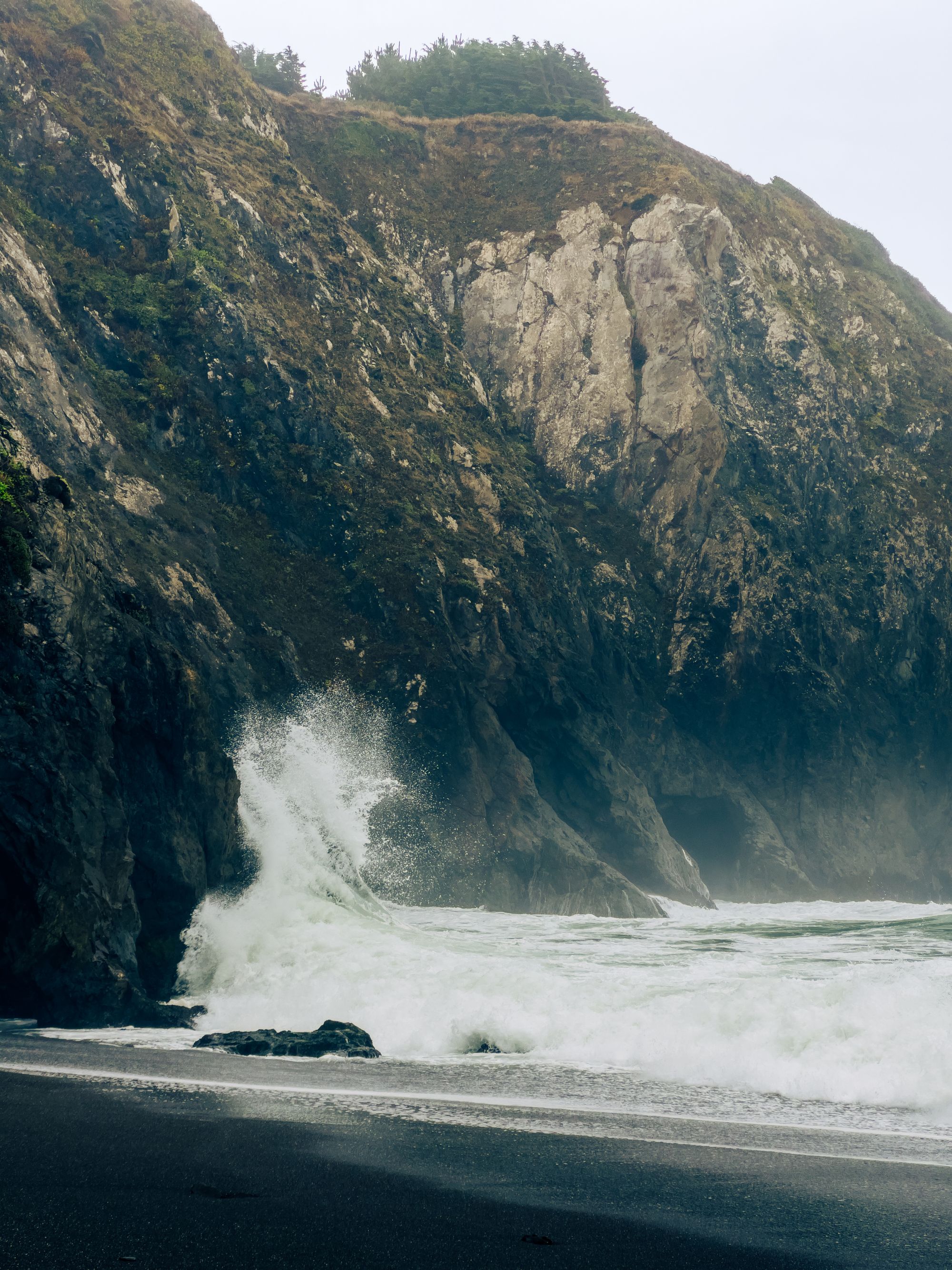
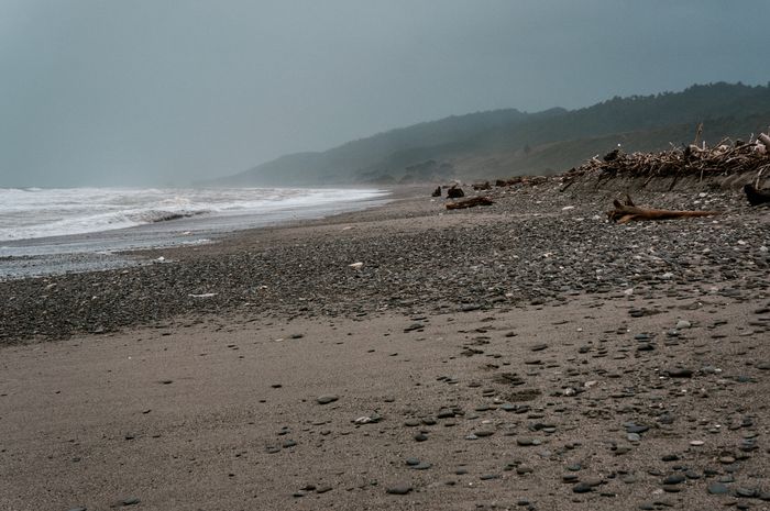
The Lost Coast Trail runs 25 miles along black sand beaches, over coastal headlands, past sea stacks and tide pools and the wreck of a 1930s freighter still visible at low tide off Shelter Cove. There are no services, no cell coverage, no facilities beyond dispersed camping. The King Range rises to 4,088 feet immediately inland, creating weather the BLM describes as one of the most challenging along the Pacific Coast. Rain is possible any month. The surf is not swimmable.

Total Distance25 mi
Tide-Dependent4 sections
DifficultyStrenuous
SurfaceBlack Sand / Coastal Rock / Headland
Crashing waves on the rocky seashore of the Lost Coast, Northern California

The full through-route requires planning around tides. Four sections between Punta Gorda and Miller Flat cannot be passed at high tide: the ocean runs to the cliff base and there is no route above. Running south to north (preferred, wind at your back) means timing movement through those sections at low tide windows. The BLM publishes a tide chart specific to the Lost Coast; print it before you lose signal, or download the NOAA tide chart for the Shelter Cove station.

Most trail runners approach this as a two-day effort: 25 miles with overnight camp at one of the designated beach sites. The beach running is harder than it reads. Black sand is heavy and loose, your ankles work constantly to stabilize, and the boulder-hop sections near the headlands require hands and judgment. This is not a run measured in minutes per mile.

"They concluded 25 miles of California coast were unbuildable and left it alone. Not lost in the sense of forgotten. Lost in the sense of having escaped."
Driftwood on the black sand beach of the Lost Coast, Humboldt County, Northern CaliforniaCamper van at a coastal sunset on the Lost Coast, King Range, Northern California

What the Lost Coast offers that nowhere else in California offers is temporal displacement. You are standing in the same place that existed before the highway, before the development, before the modern state made its improvements. Black bears cross the beach at dawn. Roosevelt elk graze the coastal terrace. Gray whales pass offshore during migration. The seal colonies on the rocks below Punta Gorda lighthouse bark through the night.

Couple standing at the edge of the Lost Coast at sunset, black sand and Pacific Ocean
Dramatic California coastal cliffs and waves, Lost Coast, Humboldt CountyCrashing Pacific surf on the rocky Lost Coast shoreline, Northern CaliforniaThe Lost Coast at sunset, black sand beach and King Range behind

TRAIL MAP · BLACK SANDS BEACH · SHELTER COVE · HUMBOLDT COUNTY

Pack Right

A BLM permit ($8/night) is required for overnight camping May through September. Download the tide table PDF before leaving cell coverage. Bear canisters are required. Bring a waterproof shell and merino base layers; coastal weather changes fast. The nearest emergency services are over an hour from the trailhead. This run rewards experience and penalizes overconfidence.

You finish at Black Sands Beach in Shelter Cove, where a small community faces the ocean at the end of a road that goes no further. The last mile is on the beach itself: black sand soft underfoot, the Pacific just to your left, the King Range behind you. It is not a finish line. It is just the place where the trail runs out of coast.

California Coastal Humboldt TRAILHEAD Wilderness

Older Post Newer Post

Leave a comment

TRAILHEAD A Trail Running Series by LLRULE

RSS

Tags

A hiker climbing iron rungs bolted into granite cliff on the Precipice Trail, Acadia National Park, Maine
Acadia Cadillac Mountain Coastal Hiking Maine National Park Precipice Trail Trail Running TRAILHEAD

Acadia: The First Light

TRAILHEAD · ACADIA NATIONAL PARK · MAINE Between early October and early March, the first sunlight to touch United States soil lands on the summit...

Read more
A hiker crosses a suspension bridge on the Wonderland Trail, Mount Rainier National Park, Washington
Hiking Mount Rainier National Park Trail Running TRAILHEAD Volcano Washington Wonderland Trail

Mount Rainier: Ninety-Three Miles Around a Volcano

TRAILHEAD · MOUNT RAINIER NATIONAL PARK · WASHINGTON Mount Rainier is a stratovolcano, which is a useful fact to carry with you on the Wonderland...

Read more
A climber on the Chasm View section of Longs Peak, Rocky Mountain National Park, Colorado
14er Alpine Colorado Hiking Longs Peak National Park Rocky Mountain Trail Running TRAILHEAD

Rocky Mountain: The Air Above Twelve

TRAILHEAD · ROCKY MOUNTAIN NATIONAL PARK · COLORADO The alarm goes off at 2:30 a.m. in Estes Park, and you are already calculating: the trailhead...

Read more
Two backpackers on trail with Grand Teton rising behind them, Grand Teton National Park, Wyoming
Cascade Canyon Grand Teton Hiking National Park Trail Running TRAILHEAD Wilderness Wyoming

Grand Teton: No Foothills, No Warning

TRAILHEAD · GRAND TETON NATIONAL PARK · WYOMING Most mountain ranges give you foothills first. A gradual grade up through lower elevations, through transitional terrain,...

Read more
A person exploring an ice cave in Glacier National Park, Montana
Glacier Highline Trail Hiking Montana National Park Trail Running TRAILHEAD Wilderness

Glacier: Running with Bears

TRAILHEAD · GLACIER NATIONAL PARK · MONTANA You carry bear spray on your hip from the moment you step out of the car at Logan...

Read more
Yosemite: Above the Valley Floor
California Half Dome Hiking National Park Trail Running TRAILHEAD Yosemite

Yosemite: Above the Valley Floor

TRAILHEAD · YOSEMITE NATIONAL PARK · CALIFORNIA The trail up Half Dome begins in shadow. At the Happy Isles trailhead, before dawn has pushed full...

Read more
Hikers descending the South Kaibab Trail, Grand Canyon National Park, Arizona
arizona camping grand canyon national parks rim-to-rim southwest trail running

Grand Canyon: Rim to River to Rim

TRAILHEAD · GRAND CANYON NATIONAL PARK · ARIZONA Every trail run begins with a descent. The Grand Canyon is the only one in America where...

Read more
How to Read a Trail
Craft Skill Trail Running TRAILHEAD Training

How to Read a Trail

Road runners look at where their feet are. Trail runners look at where their feet are going to be. The skill that separates them is...

Read more
Sedona After Sunrise: Red Rock Before the Heat
Arizona Desert Red Rock Sedona TRAILHEAD

Sedona After Sunrise: Red Rock Before the Heat

The red rocks of Sedona hold heat from the day before. Run them at first light, when the temperature is still in the fifties and...

Read more
Malibu Creek: The Santa Monicas' Best Kept Secret
California Los Angeles Malibu Santa Monica Mountains TRAILHEAD

Malibu Creek: The Santa Monicas' Best Kept Secret

Twenty-six miles from the Pacific Coast Highway, Malibu Creek State Park holds 4,000 acres of California chaparral, volcanic rock, creek crossings, and a trail system...

Read more
Columbia River Gorge: Wind, Basalt, and Wildflowers
Columbia River Oregon Pacific Northwest TRAILHEAD Washington Waterfalls

Columbia River Gorge: Wind, Basalt, and Wildflowers

The Columbia River Gorge holds more waterfalls per square mile than anywhere in North America. In spring, the basalt walls run with snowmelt and the...

Read more
Zion Narrows slot canyon
Canyon Desert TRAILHEAD Utah Zion

Zion Narrows: The River Is the Trail

There is no trail through the Zion Narrows. There is only the Virgin River and the canyon walls above it — a thousand feet of...

Read more
Hurricane Ridge alpine trail in Olympic National Park
Alpine Olympic Peninsula Pacific Northwest TRAILHEAD Washington

Hurricane Ridge: Above the Clouds

The Olympic Mountains hold snow until July. The views from Hurricane Ridge reach across the Strait of Juan de Fuca into Canada. This is the...

Read more
Point Reyes coastal trail in morning fog
California Coastal Marin County Point Reyes TRAILHEAD

Point Reyes: Running the Edge of the World

Fog. Elk. A two-hundred-foot cliff above the Pacific. The Bear Valley to Arch Rock corridor is one of the most dramatic trail runs on the...

Read more
Yosemite Sentinel Dome
Exploration TRAILHEAD Yosemite

Yosemite Sentinel Dome

At 8,122 feet, Sentinel Dome delivers one of the most rewarding views in the Sierra Nevada — and only asks two miles from you to...

Read more
Running Yosemites Most Scenic - Mirror Lake Loop
Exploration TRAILHEAD

Running Yosemites Most Scenic - Mirror Lake Loop

Mirror Lake isn't a destination — it's a mirror. Five miles through the floor of Yosemite Valley, with Half Dome doubling itself in still water.

Read more
Chase the Falls: Running Whatcom Falls Park
Exploration TRAILHEAD

Chase the Falls: Running Whatcom Falls Park

The falls are the destination, but the miles getting there are the point. A technical loop through old-growth forest, creek crossings, and stone bridges.

Read more
TRAILHEAD: Running the Interurban Trail
Exploration TRAILHEAD

TRAILHEAD: Running the Interurban Trail

Sixteen miles of converted rail corridor through Bellingham, Washington. A case for the urban trail as a form of moving meditation.

Read more
TRAILHEAD: Stimpson Family Nature Reserve
Exploration TRAILHEAD

TRAILHEAD: Stimpson Family Nature Reserve

A thousand acres of old-growth cedar and fir, ridgelines that open into sky, and a trail system built for those who want to disappear into...

Read more
Ridgeflow™: Where Perseverance Meets Performance
Community Resilience Performance Gear Ridgeflow

Ridgeflow™: Where Perseverance Meets Performance

The Ridgeflow silhouette was built for one purpose: outlast the terrain. Engineered for the runner who doesn't stop when the trail gets hard.

Read more
Joshua Tree: Where Time Bends and Creativity Breaks Open
Exploration TRAILHEAD

Joshua Tree: Where Time Bends and Creativity Breaks Open

In the Mojave, the landscape doesn't just challenge you — it changes you. A run through Joshua Tree is a reckoning with silence, scale, and...

Read more
TERRAIN
TRAILHEAD
THE DRIFT
DISPATCH